

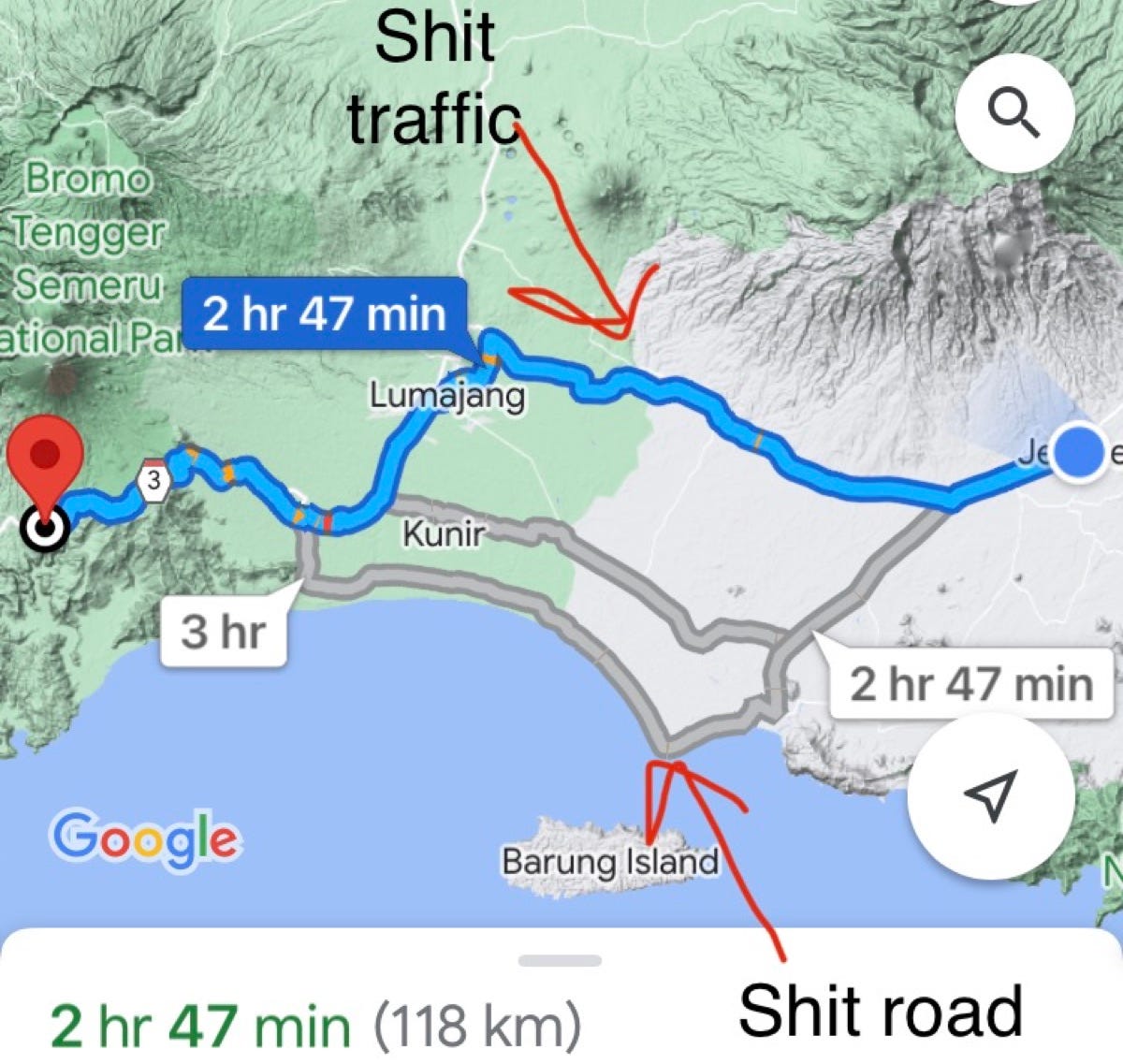
Google Maps tells us we have three options for reaching our homestay near the waterfall. The northern route on Route 3, a coastal route, and one in between. All are estimated to take around three hours.
I stare at the map for a while. On Route 3, I figure we’ll have shit traffic, while the coastal route will probably be a shit road. Like is full of choices right? We decide to make our decision on the fly, as the roads don’t diverge till around 20 minutes west of Jember. It takes me all of five of those twenty minutes to decide on taking the coast road.
Trip-planning with Stuart.
At the other end of our journey, overshadowing the waterfall, stands Mount Semeru, the tallest volcano on Java. It’s also one of the most volatile, with over 15 major eruptions since the 1940s. It’s a spectacular peak, and a dangerous one to climb even in non-erupting times. I’ve only ever seen it in the far distance, but where we’re heading it anchors the entire scene.
We turn left, and the traffic drops off immediately. There are still some, cars, bikes and corn trucks, but it’s nothing compared to the bedlam of Route 3. I accelerate on the smooth surface, and we race south, gathering time.
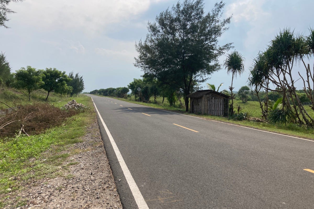
Engage the warp engines Mr Zulu. Photo: Stuart McDonald.
On December 1 and 2 in 2021, after a prolonged period of torrential rain, concerns arise regarding activity at Semeru. A warning is distributed by the Center of Volcanology and Geological Hazard Mitigation to a WhatsApp group and nearby villages. Later it emerges many villagers don’t receive the warning.
We continue south, it’s plain sailing and I ride ever-expecting the road to fall apart. It doesn’t, and we hit the coastal strip and a small fishing village. Half the town is dug up for what looks like water mains, but the road is new. We keep going, eventually reaching the "tourist location" of Pantai Paseban. We park and give the Ibu 5,000 rupiah then climb over the dunes. The charcoal-coloured beach is as long as it is filthy. There’s an oddly placed lighthouse to our left and a headland after it, but that’s it. I take a quick paddle and we leave.
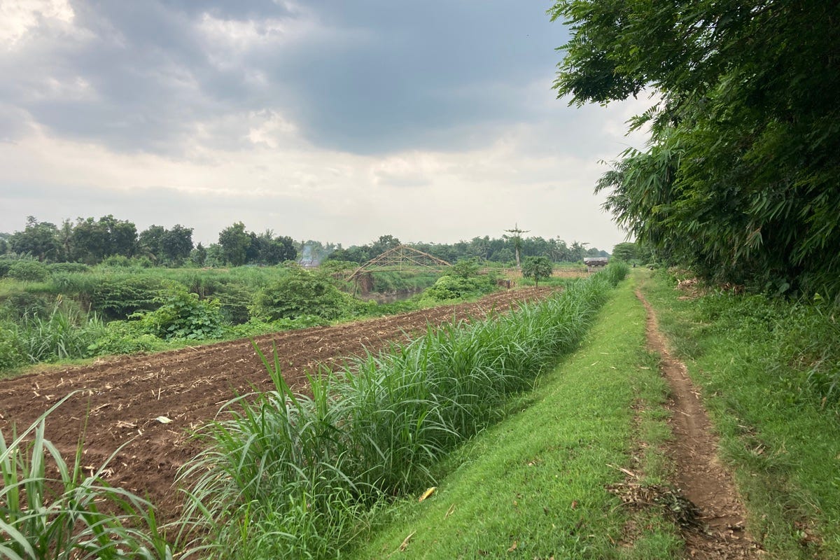
Google says this is a road. Note the bridge. Photo: Stuart McDonald.
On December 4, Semeru’s lava dome collapses under pressure from the rain and at 14:50 local time, the peak erupts, sending an ash plume over twelve kilometres into the sky. A pyroclastic flow—or lahar—surges down from the peak towards the villages set in the shadow of the peak.
Heading west from the beach, we follow the coast. The road is near highway standards and we’re the only vehicle on it. Will shouts we follow it for 20km, and I reach, for the first and probably only time in Java, 100km/h as we race along. It can’t last, I keep thinking, yet after every sweeping bend it continues, our very own blue metal strip bringing us towards our target.
Oh Java. Photo: Stuart McDonald.
The lahar surges down the volcano’s slopes, as local people panic and flee. The Gladak Perak Bridge, a vital link between the east and west collapses under the pressure of the flow, killing at least three people. Villages below the bridge are submerged, while people as far away as Malang report heavy ash falls. With the bridge cut, access for emergency services is severed. Established evacuation protocols fell apart and a camp for evacuees is submerged by the lahar. Within ten days the official death toll would be over 50, with over 5,000 houses damaged or destroyed, and over 10,000 people displaced.
Good things don’t last, and we reach a sign blocking the road, bridge building equipment behind it, we veer off onto a dirt track that becomes a goat track then a line in a grass atop a rampart to control the river to our left. Farmers cut grass with scissors and tend crops, smiling curiously as we go past.
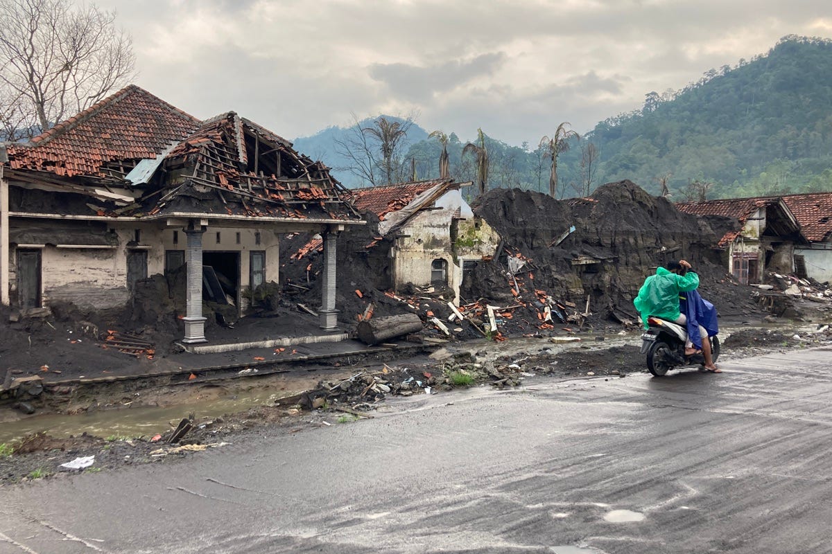
When the lahar came. Photo: Stuart McDonald.
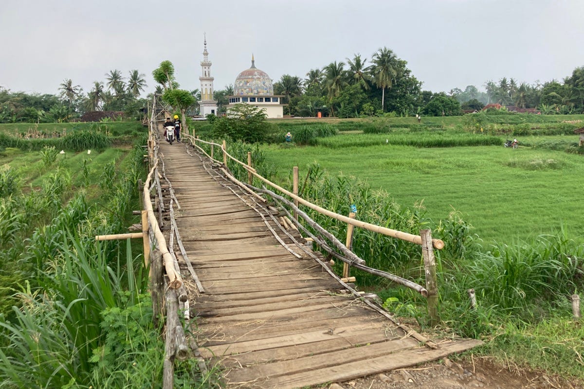
Our bridge, when it appears, is the kind of thing I’d build out of paddle pop sticks. Will walks over as I ride, a pretty mosque in the background. In another twenty minutes, we’re back on our personal highway and we hit the Pamdanwangi Bridge, offering tremendous views. Lined with merchants selling cup noodles and coffee we linger, then leave the coast behind and head towards Djarit.
Not long after, we reach the sepulchral scene left behind by Semeru. At first, I think it is heavy-duty roadworks that required the demolishing of some houses, but then I realize what I’m looking at. Sheer devastation. Behind the buried houses, sad ghostlike palms, burnt to a crisp, stand in the thick black soil the lahar left behind. On the street side, it’s an easy three meters deep.
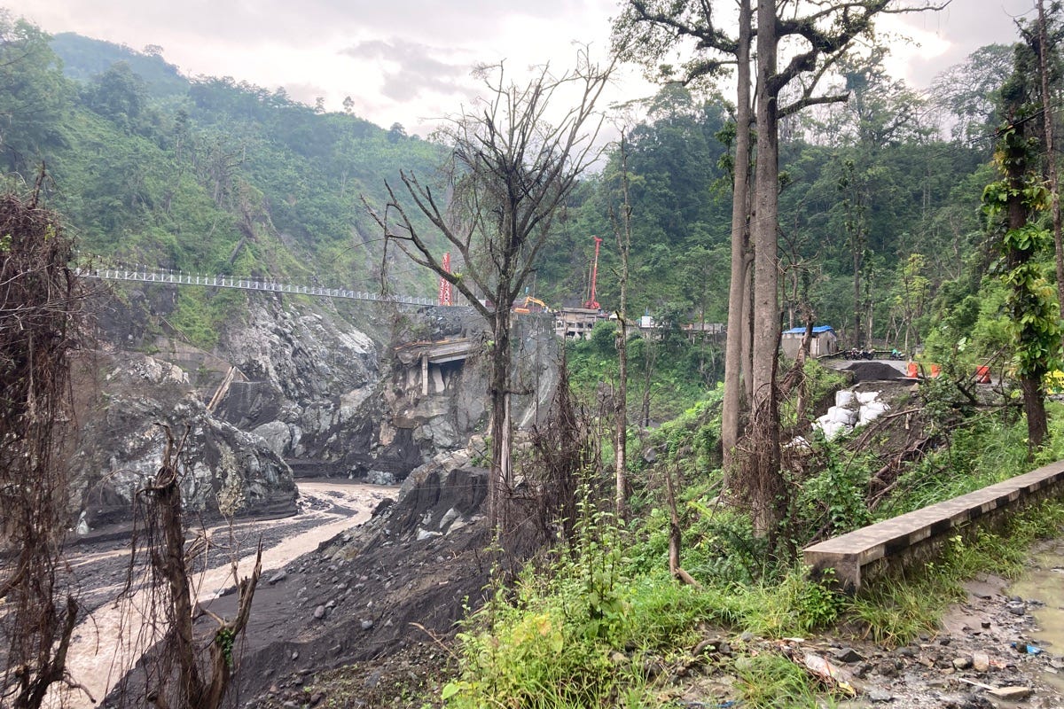
Bridge broken. Photo: Stuart McDonald.
We reach the Gladak Perak Bridge. It must have been spectacular when it stood, but now it lies in the sheer valley’s base, broken sections, road markings at perverse angles. Beyond it, a vast field of black soil, the size of hundreds of football fields, sprawls, devoid of life. We ride across a just-opened suspension bridge and back into the woods.
We wheel through the forest in the late afternoon cool thanks to some rain we mostly missed. The devastation left behind is replaced by a scene as beautiful as it is serene.
Couchfish is 100 per cent independent and reader-supported. If you’re not already a subscriber, and you’d like to show your support, become a paying subscriber today for just US$7 per month—you can find out more about Couchfish here—or simply share this story with a friend.
Don’t forget, you can find the free podcasts on Apple, Pocket Casts and Spotify as well as right here on Couchfish.


